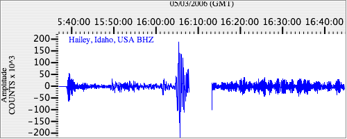
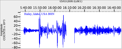
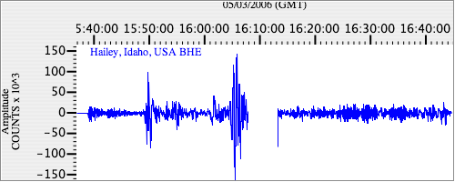
Seismograms for this Event
Event Info
| Region | Tonga Islands |
| Time | 2006-05-03 11:26:35 -0400 |
| Magnitude | 8.0 MO, |
| Depth | 16.1 km |
| Latitude | -20.0346 |
| Longitude | -174.2272 |
| Distance | 83.696 deg |
| Azimuth | 39.211 deg |
| Back Azimuth | 234.852 deg |
Station Info
| Id | HLID |
| Name | Hailey, Idaho, USA |
| Latitude | 43.5625 |
| Longitude | -114.4138 |
| Begin Time | 1998-08-09 20:00:00 -0400 |
| End Time | 2999-12-31 18:59:59 -0500 |
Seismograms
| US.HLID. .BHZ 11.3964815 AD 2006.05.03 15:34:44.400 GMT |
|
| US.HLID. .BHN 2.1426816 AD 2006.05.03 15:34:54.900 GMT |
|
| US.HLID. .BHE 5.1156273 AD 2006.05.03 15:34:40.100 GMT |
|