Seismograms for this Event
Event Info
| Region | Tonga Islands |
| Time | 2006-05-03 11:26:35 -0400 |
| Magnitude | 8.0 MO, |
| Depth | 16.1 km |
| Latitude | -20.0346 |
| Longitude | -174.2272 |
| Distance | 82.513 deg |
| Azimuth | 34.729 deg |
| Back Azimuth | 230.705 deg |
Station Info
| Id | HAWA |
| Name | Hanford, Washington, USA |
| Latitude | 46.3925 |
| Longitude | -119.5326 |
| Begin Time | 1999-04-22 20:00:00 -0400 |
| End Time | 2999-12-31 18:59:59 -0500 |
Seismograms
| US.HAWA. .BHZ 6.927634 AD 2006.05.03 15:34:33.149 GMT |
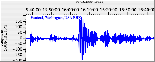
|
| US.HAWA. .BHN 2.598407 AD 2006.05.03 15:34:44.449 GMT |
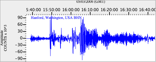
|
| US.HAWA. .BHE 2.5050902 AD 2006.05.03 15:34:52.149 GMT |
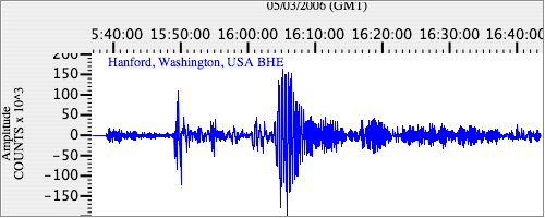
|