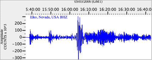
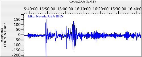
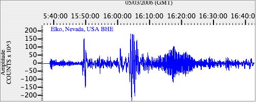
Seismograms for this Event
Event Info
| Region | Tonga Islands |
| Time | 2006-05-03 11:26:35 -0400 |
| Magnitude | 8.0 MO, |
| Depth | 16.1 km |
| Latitude | -20.0346 |
| Longitude | -174.2272 |
| Distance | 81.568 deg |
| Azimuth | 41.17 deg |
| Back Azimuth | 234.551 deg |
Station Info
| Id | ELK |
| Name | Elko, Nevada, USA |
| Latitude | 40.74484 |
| Longitude | -115.23878 |
| Begin Time | 1994-01-05 19:00:00 -0500 |
| End Time | 2599-12-31 18:59:59 -0500 |
Seismograms
| US.ELK. .BHZ 6.1834 AD 2006.05.03 15:34:36.980 GMT |
|
| US.ELK. .BHN 2.0917218 AD 2006.05.03 15:34:32.380 GMT |
|
| US.ELK. .BHE 2.515796 AD 2006.05.03 15:34:17.229 GMT |
|