Seismograms for this Event
Event Info
| Region | Tonga Islands |
| Time | 2006-05-03 11:26:35 -0400 |
| Magnitude | 8.0 MO, |
| Depth | 16.1 km |
| Latitude | -20.0346 |
| Longitude | -174.2272 |
| Distance | 76.757 deg |
| Azimuth | 40.917 deg |
| Back Azimuth | 231.249 deg |
Station Info
| Id | CMB |
| Name | Columbia College, California, USA |
| Latitude | 38.035 |
| Longitude | -120.385 |
| Begin Time | 1992-09-09 20:00:00 -0400 |
| End Time | 2599-12-31 18:59:59 -0500 |
Seismograms
| US.CMB. .BHZ 5.3228292 AD 2006.05.03 15:34:02.846 GMT |
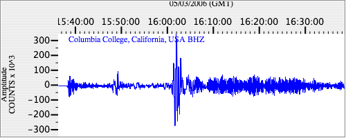
|
| US.CMB. .BHN 2.0695214 AD 2006.05.03 15:34:09.846 GMT |
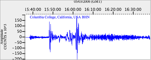
|
| US.CMB. .BHE 2.9122539 AD 2006.05.03 15:34:07.896 GMT |
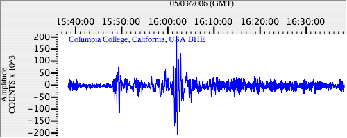
|