Seismograms for this Event
Event Info
| Region | Tonga Islands |
| Time | 2006-05-03 11:26:35 -0400 |
| Magnitude | 8.0 MO, |
| Depth | 16.1 km |
| Latitude | -20.0346 |
| Longitude | -174.2272 |
| Distance | 61.407 deg |
| Azimuth | 256.275 deg |
| Back Azimuth | 101.887 deg |
Station Info
| Id | MBWA |
| Name | Marble Bar, Western Australia |
| Latitude | -21.159 |
| Longitude | 119.7312 |
| Begin Time | 2001-08-24 20:00:00 -0400 |
| End Time | 2599-12-31 18:59:59 -0500 |
Seismograms
| IU.MBWA.00.BHZ 32.203537 AD 2006.05.03 15:31:57.823 GMT |
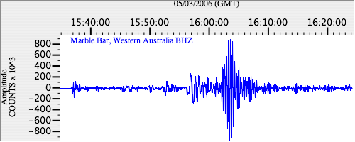
|
| IU.MBWA.00.BH1 18.497887 AD 2006.05.03 15:32:01.623 GMT |
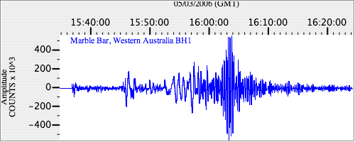
|
| IU.MBWA.00.BH2 17.072956 AD 2006.05.03 15:32:18.523 GMT |
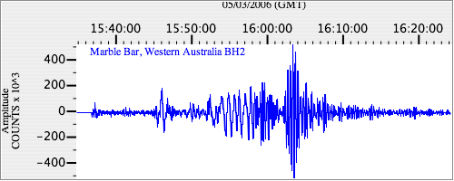
|