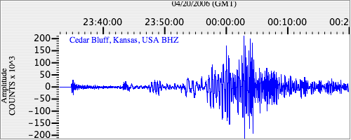
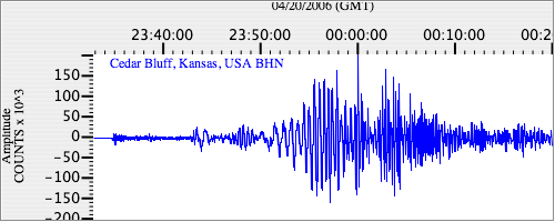
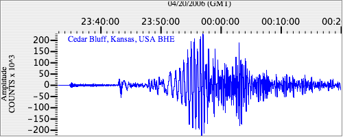
Seismograms for this Event
Event Info
| Region | Eastern Siberia, Russia |
| Time | 2006-04-20 19:25:04 -0400 |
| Magnitude | 7.7 M, |
| Depth | 38.5 km |
| Latitude | 61.07 |
| Longitude | 167.06 |
| Distance | 58.382 deg |
| Azimuth | 66.346 deg |
| Back Azimuth | 325.243 deg |
Station Info
| Id | CBKS |
| Name | Cedar Bluff, Kansas, USA |
| Latitude | 38.814 |
| Longitude | -99.7374 |
| Begin Time | 1994-09-11 20:00:00 -0400 |
| End Time | 2999-12-31 18:59:59 -0500 |
Seismograms
| US.CBKS. .BHZ 57.261875 AD 2006.04.20 23:30:52.597 GMT |
|
| US.CBKS. .BHN 17.099823 AD 2006.04.20 23:30:32.197 GMT |
|
| US.CBKS. .BHE 13.021095 AD 2006.04.20 23:30:32.347 GMT |
|