Seismograms for this Event
Event Info
| Region | Banda Sea |
| Time | 2006-01-27 11:58:48 -0500 |
| Magnitude | 7.5 MO, |
| Depth | 341.5 km |
| Latitude | -5.4482 |
| Longitude | 128.0991 |
| Distance | 17.601 deg |
| Azimuth | 206.693 deg |
| Back Azimuth | 28.628 deg |
Station Info
| Id | MBWA |
| Name | Marble Bar, Western Australia |
| Latitude | -21.159 |
| Longitude | 119.7312 |
| Begin Time | 2001-08-24 20:00:00 -0400 |
| End Time | 2599-12-31 18:59:59 -0500 |
Seismograms
| IU.MBWA.00.BHZ 57.59785 AD 2006.01.27 16:54:46.311 GMT |
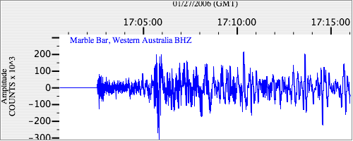
|
| IU.MBWA.00.BH1 31.255686 AD 2006.01.27 16:52:35.511 GMT |
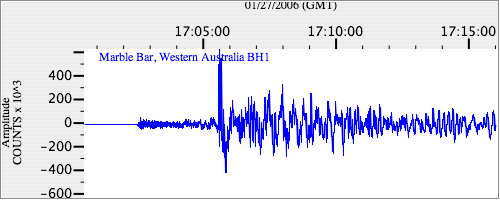
|
| IU.MBWA.00.BH2 77.7267 AD 2006.01.27 16:52:49.811 GMT |
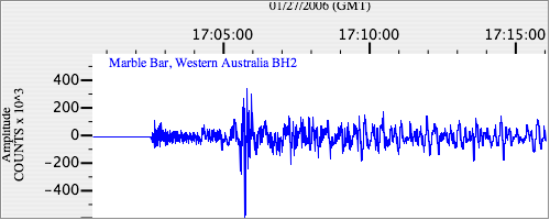
|