Seismograms for this Event
Event Info
| Region | Banda Sea |
| Time | 2006-01-27 11:58:48 -0500 |
| Magnitude | 7.5 MO, |
| Depth | 341.5 km |
| Latitude | -5.4482 |
| Longitude | 128.0991 |
| Distance | 22.878 deg |
| Azimuth | 131.121 deg |
| Back Azimuth | 307.069 deg |
Station Info
| Id | CTAO |
| Name | Charters Towers, Australia |
| Latitude | -20.0882 |
| Longitude | 146.2545 |
| Begin Time | 1998-10-06 17:00:00 -0400 |
| End Time | 2599-12-31 18:59:59 -0500 |
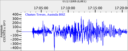
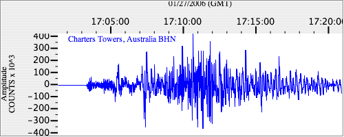
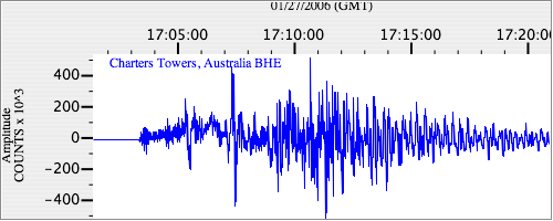
Seismograms
| IU.CTAO.00.BHZ 46.54595 AD 2006.01.27 16:55:58.861 GMT |
|
| IU.CTAO.00.BHN 29.404455 AD 2006.01.27 16:57:25.961 GMT |
|
| IU.CTAO.00.BHE 35.97584 AD 2006.01.27 16:59:09.361 GMT |
|