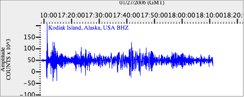
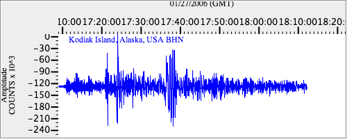
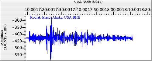
Seismograms for this Event
Event Info
| Region | Banda Sea |
| Time | 2006-01-27 11:58:48 -0500 |
| Magnitude | 7.5 MO, |
| Depth | 341.5 km |
| Latitude | -5.4482 |
| Longitude | 128.0991 |
| Distance | 88.899 deg |
| Azimuth | 31.77 deg |
| Back Azimuth | 258.089 deg |
Station Info
| Id | KDAK |
| Name | Kodiak Island, Alaska, USA |
| Latitude | 57.7828 |
| Longitude | -152.5835 |
| Begin Time | 1997-06-08 20:00:00 -0400 |
| End Time | 2599-12-31 18:59:59 -0500 |
Seismograms
| II.KDAK.00.BHZ 14.547771 AD 2006.01.27 17:06:29.550 GMT |
|
| II.KDAK.00.BHN 2.3790882 AD 2006.01.27 17:04:39.150 GMT |
|
| II.KDAK.00.BHE 4.227481 AD 2006.01.27 17:05:17.150 GMT |
|