Seismograms for this Event
Event Info
| Region | Lake Tanganyika Region |
| Time | 2005-12-05 07:19:56 -0500 |
| Magnitude | 6.4 MB, 7.2 MS, 6.8 MW, 6.7 MW, |
| Depth | 22.0 km |
| Latitude | -6.224 |
| Longitude | 29.83 |
| Distance | 48.147 deg |
| Azimuth | 15.355 deg |
| Back Azimuth | 200.087 deg |
Station Info
| Id | GNI |
| Name | Garni, Armenia |
| Latitude | 40.148 |
| Longitude | 44.741 |
| Begin Time | 1997-05-18 20:00:00 -0400 |
| End Time | 2599-12-31 18:59:59 -0500 |
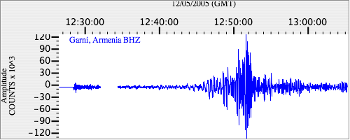
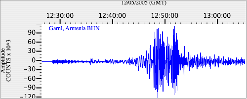
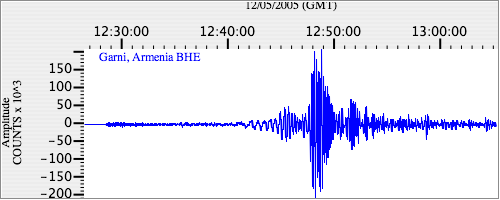
Seismograms
| IU.GNI.00.BHZ 22.255915 AD 2005.12.05 12:22:05.473 GMT |
|
| IU.GNI.00.BHN 9.392127 AD 2005.12.05 12:24:02.773 GMT |
|
| IU.GNI.00.BHE 4.0993347 AD 2005.12.05 12:23:44.673 GMT |
|