Seismograms for this Event
Event Info
| Region | Off East Coast Of Honshu, Japan |
| Time | 2005-11-14 16:38:51 -0500 |
| Magnitude | 6.7 MB, 6.8 MS, 7.0 MW, 6.9 MW, |
| Depth | 11.0 km |
| Latitude | 38.107 |
| Longitude | 144.896 |
| Distance | 70.005 deg |
| Azimuth | 45.794 deg |
| Back Azimuth | 304.555 deg |
Station Info
| Id | MSO |
| Name | Missoula, Montana, USA |
| Latitude | 46.8292 |
| Longitude | -113.9406 |
| Begin Time | 2002-08-23 13:00:00 -0400 |
| End Time | 2999-12-31 18:59:59 -0500 |
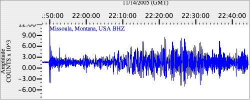
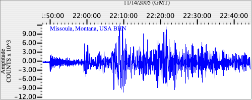
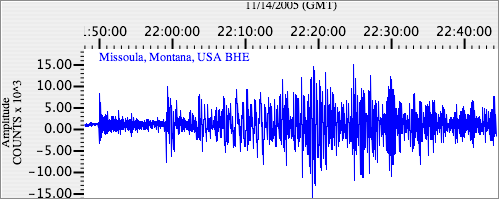
Seismograms
| US.MSO. .BHZ 19.408863 AD 2005.11.14 21:45:53.541 GMT |
|
| US.MSO. .BHN 3.6381288 AD 2005.11.14 21:45:54.841 GMT |
|
| US.MSO. .BHE 3.744286 AD 2005.11.14 21:45:57.541 GMT |
|