Seismograms for this Event
Event Info
| Region | Off East Coast Of Honshu, Japan |
| Time | 2005-11-14 16:38:51 -0500 |
| Magnitude | 6.7 MB, 6.8 MS, 7.0 MW, 6.9 MW, |
| Depth | 11.0 km |
| Latitude | 38.107 |
| Longitude | 144.896 |
| Distance | 84.581 deg |
| Azimuth | 53.707 deg |
| Back Azimuth | 311.761 deg |
Station Info
| Id | MNTX |
| Name | Cornudas Mountains, Texas, USA |
| Latitude | 31.6985 |
| Longitude | -105.3821 |
| Begin Time | 2004-04-01 01:00:00 -0500 |
| End Time | 2999-12-31 18:59:59 -0500 |
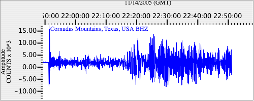
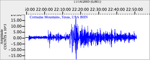
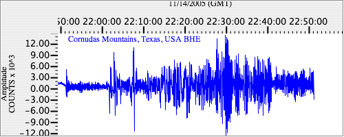
Seismograms
| US.MNTX. .BHZ 13.259316 AD 2005.11.14 21:47:03.811 GMT |
|
| US.MNTX. .BHN 2.2027287 AD 2005.11.14 21:47:05.211 GMT |
|
| US.MNTX. .BHE 2.7628295 AD 2005.11.14 21:47:03.711 GMT |
|