Seismograms for this Event
Event Info
| Region | Off East Coast Of Honshu, Japan |
| Time | 2005-11-14 16:38:51 -0500 |
| Magnitude | 6.7 MB, 6.8 MS, 7.0 MW, 6.9 MW, |
| Depth | 11.0 km |
| Latitude | 38.107 |
| Longitude | 144.896 |
| Distance | 67.011 deg |
| Azimuth | 48.444 deg |
| Back Azimuth | 301.474 deg |
Station Info
| Id | HAWA |
| Name | Hanford, Washington, USA |
| Latitude | 46.3925 |
| Longitude | -119.5326 |
| Begin Time | 1999-04-22 20:00:00 -0400 |
| End Time | 2999-12-31 18:59:59 -0500 |
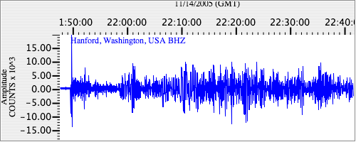
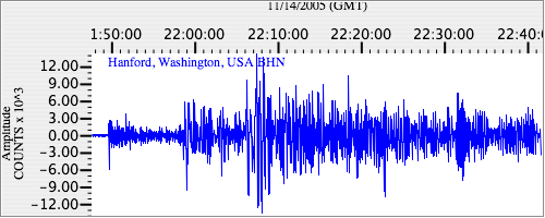
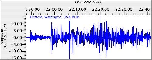
Seismograms
| US.HAWA. .BHZ 7.467765 AD 2005.11.14 21:45:31.825 GMT |
|
| US.HAWA. .BHN 2.950765 AD 2005.11.14 21:45:28.825 GMT |
|
| US.HAWA. .BHE 2.9661982 AD 2005.11.14 21:45:31.274 GMT |
|