Seismograms for this Event
Event Info
| Region | Northern Peru |
| Time | 2005-09-25 21:55:34 -0400 |
| Magnitude | 7.5 MO, |
| Depth | 85.4 km |
| Latitude | -5.6567 |
| Longitude | -76.3661 |
| Distance | 44.627 deg |
| Azimuth | 348.855 deg |
| Back Azimuth | 165.863 deg |
Station Info
| Id | WCI |
| Name | Wyandotte Cave, Indiana, USA |
| Latitude | 38.229 |
| Longitude | -86.29381 |
| Begin Time | 1996-11-05 19:00:00 -0500 |
| End Time | 2599-12-31 18:59:59 -0500 |
Seismograms
| US.WCI. .BHZ 77.98761 AD 2005.09.26 01:59:19.721 GMT |
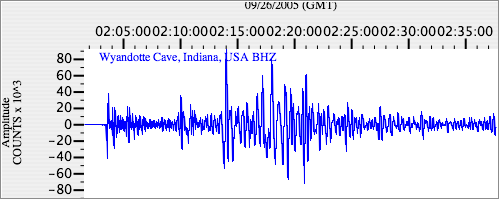
|
| US.WCI. .BHN 41.134933 AD 2005.09.26 01:59:22.721 GMT |
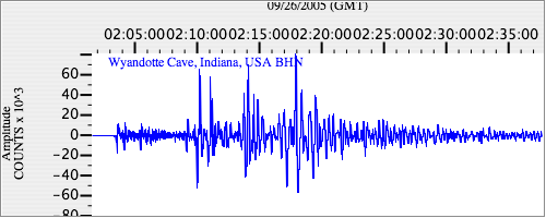
|
| US.WCI. .BHE 16.501223 AD 2005.09.26 01:59:19.721 GMT |
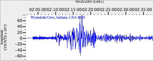
|