Seismograms for this Event
Event Info
| Region | Northern Peru |
| Time | 2005-09-25 21:55:34 -0400 |
| Magnitude | 7.5 MO, |
| Depth | 85.4 km |
| Latitude | -5.6567 |
| Longitude | -76.3661 |
| Distance | 50.994 deg |
| Azimuth | 330.22 deg |
| Back Azimuth | 141.426 deg |
Station Info
| Id | SDCO |
| Name | Great Sand Dunes National Park, Colorado, USA |
| Latitude | 37.7456 |
| Longitude | -105.5012 |
| Begin Time | 2002-07-10 20:00:00 -0400 |
| End Time | 2999-12-31 18:59:59 -0500 |
Seismograms
| US.SDCO. .BHZ 159.17288 AD 2005.09.26 02:00:13.783 GMT |
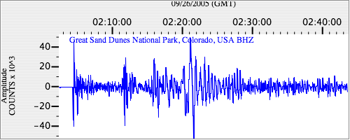
|
| US.SDCO. .BHN 30.413929 AD 2005.09.26 02:00:13.183 GMT |
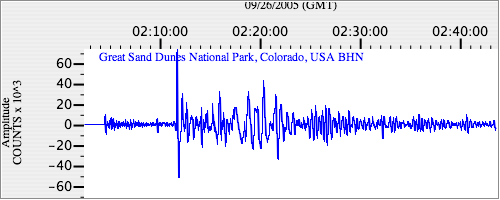
|
| US.SDCO. .BHE 44.245995 AD 2005.09.26 02:00:11.483 GMT |
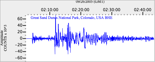
|