Seismograms for this Event
Event Info
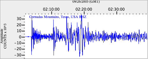
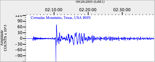
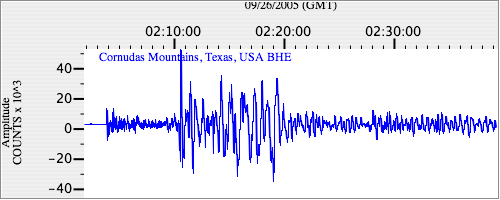
| Region | Northern Peru |
| Time | 2005-09-25 21:55:34 -0400 |
| Magnitude | 7.5 MO, |
| Depth | 85.4 km |
| Latitude | -5.6567 |
| Longitude | -76.3661 |
| Distance | 46.32 deg |
| Azimuth | 325.131 deg |
| Back Azimuth | 138.128 deg |
Station Info
| Id | MNTX |
| Name | Cornudas Mountains, Texas, USA |
| Latitude | 31.6985 |
| Longitude | -105.3821 |
| Begin Time | 2004-04-01 01:00:00 -0500 |
| End Time | 2999-12-31 18:59:59 -0500 |
Seismograms
| US.MNTX. .BHZ 81.89487 AD 2005.09.26 01:59:50.049 GMT |
|
| US.MNTX. .BHN 62.157215 AD 2005.09.26 01:59:50.049 GMT |
|
| US.MNTX. .BHE 38.578804 AD 2005.09.26 01:59:49.849 GMT |
|