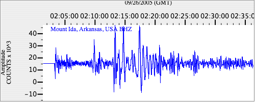
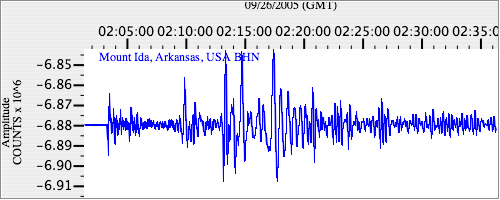
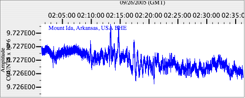
Seismograms for this Event
Event Info
| Region | Northern Peru |
| Time | 2005-09-25 21:55:34 -0400 |
| Magnitude | 7.5 MO, |
| Depth | 85.4 km |
| Latitude | -5.6567 |
| Longitude | -76.3661 |
| Distance | 43.161 deg |
| Azimuth | 339.081 deg |
| Back Azimuth | 154.503 deg |
Station Info
| Id | MIAR |
| Name | Mount Ida, Arkansas, USA |
| Latitude | 34.5454 |
| Longitude | -93.5765 |
| Begin Time | 1992-09-22 20:00:00 -0400 |
| End Time | 2999-12-31 18:59:59 -0500 |
Seismograms
| US.MIAR. .BHZ 89.615265 AD 2005.09.26 01:59:10.650 GMT |
|
| US.MIAR. .BHN 86.11862 AD 2005.09.26 01:59:23.400 GMT |
|
| US.MIAR. .BHE 3.6721437 AD 2005.09.26 01:59:18.250 GMT |
|