Seismograms for this Event
Event Info
| Region | Northern Peru |
| Time | 2005-09-25 21:55:34 -0400 |
| Magnitude | 7.5 MO, |
| Depth | 85.4 km |
| Latitude | -5.6567 |
| Longitude | -76.3661 |
| Distance | 43.576 deg |
| Azimuth | 324.479 deg |
| Back Azimuth | 138.533 deg |
Station Info
| Id | LTX |
| Name | Lajitas, Texas, USA |
| Latitude | 29.3339 |
| Longitude | -103.6669 |
| Begin Time | 1998-05-15 20:00:00 -0400 |
| End Time | 2999-12-31 18:59:59 -0500 |
Seismograms
| US.LTX. .BHZ 78.25957 AD 2005.09.26 01:59:28.134 GMT |
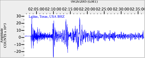
|
| US.LTX. .BHN 32.98536 AD 2005.09.26 01:59:07.834 GMT |
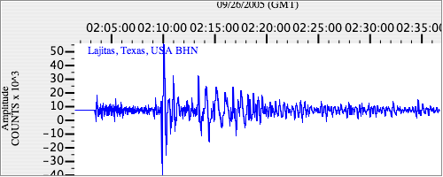
|
| US.LTX. .BHE 25.439123 AD 2005.09.26 01:59:09.934 GMT |
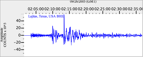
|