Seismograms for this Event
Event Info
| Region | Northern Peru |
| Time | 2005-09-25 21:55:34 -0400 |
| Magnitude | 7.5 MO, |
| Depth | 85.4 km |
| Latitude | -5.6567 |
| Longitude | -76.3661 |
| Distance | 58.457 deg |
| Azimuth | 336.289 deg |
| Back Azimuth | 144.455 deg |
Station Info
| Id | LAO |
| Name | LASA Array, Montana, USA |
| Latitude | 46.6885 |
| Longitude | -106.2231 |
| Begin Time | 2004-07-14 20:00:00 -0400 |
| End Time | 2999-12-31 18:59:59 -0500 |
Seismograms
| US.LAO. .BHZ 60.00242 AD 2005.09.26 02:01:00.617 GMT |
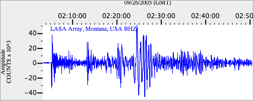
|
| US.LAO. .BHN 9.848656 AD 2005.09.26 02:00:59.017 GMT |
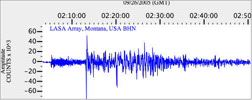
|
| US.LAO. .BHE 18.182102 AD 2005.09.26 02:01:00.017 GMT |
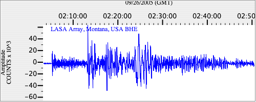
|