Seismograms for this Event
Event Info
| Region | Northern Peru |
| Time | 2005-09-25 21:55:34 -0400 |
| Magnitude | 7.5 MO, |
| Depth | 85.4 km |
| Latitude | -5.6567 |
| Longitude | -76.3661 |
| Distance | 64.423 deg |
| Azimuth | 328.335 deg |
| Back Azimuth | 130.992 deg |
Station Info
| Id | HAWA |
| Name | Hanford, Washington, USA |
| Latitude | 46.3925 |
| Longitude | -119.5326 |
| Begin Time | 1999-04-22 20:00:00 -0400 |
| End Time | 2999-12-31 18:59:59 -0500 |
Seismograms
| US.HAWA. .BHZ 78.57964 AD 2005.09.26 02:01:48.025 GMT |
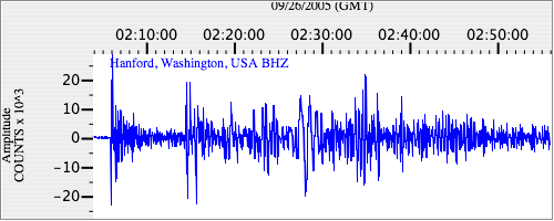
|
| US.HAWA. .BHN 36.531845 AD 2005.09.26 02:01:45.125 GMT |
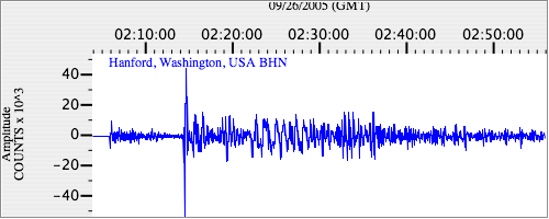
|
| US.HAWA. .BHE 28.87617 AD 2005.09.26 02:01:31.325 GMT |
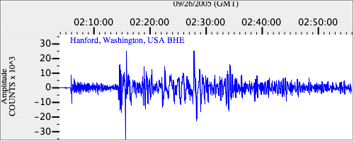
|