Seismograms for this Event
Event Info
| Region | Northern Peru |
| Time | 2005-09-25 21:55:34 -0400 |
| Magnitude | 7.5 MO, |
| Depth | 85.4 km |
| Latitude | -5.6567 |
| Longitude | -76.3661 |
| Distance | 47.66 deg |
| Azimuth | 356.353 deg |
| Back Azimuth | 175.119 deg |
Station Info
| Id | ERPA |
| Name | Erie, Pennsylvania, USA |
| Latitude | 42.1175 |
| Longitude | -79.9891 |
| Begin Time | 2004-03-18 19:00:00 -0500 |
| End Time | 2999-12-31 18:59:59 -0500 |
Seismograms
| US.ERPA. .BHZ 68.94067 AD 2005.09.26 01:59:58.413 GMT |
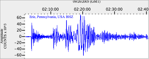
|
| US.ERPA. .BHN 43.484566 AD 2005.09.26 01:59:51.713 GMT |
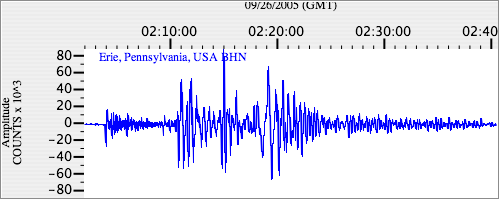
|
| US.ERPA. .BHE 3.7668753 AD 2005.09.26 01:59:54.713 GMT |
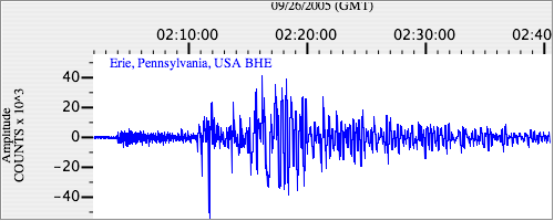
|