Seismograms for this Event
Event Info
| Region | Northern Peru |
| Time | 2005-09-25 21:55:34 -0400 |
| Magnitude | 7.5 MO, |
| Depth | 85.4 km |
| Latitude | -5.6567 |
| Longitude | -76.3661 |
| Distance | 56.615 deg |
| Azimuth | 326.977 deg |
| Back Azimuth | 134.923 deg |
Station Info
| Id | DUG |
| Name | Dugway, Tooele County, Utah, USA |
| Latitude | 40.195 |
| Longitude | -112.8133 |
| Begin Time | 1993-02-17 19:00:00 -0500 |
| End Time | 2999-12-31 18:59:59 -0500 |
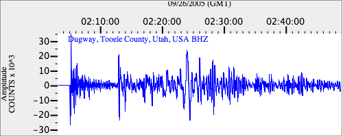
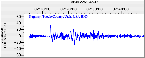
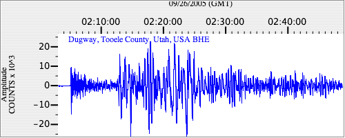
Seismograms
| US.DUG. .BHZ 157.34218 AD 2005.09.26 02:00:47.874 GMT |
|
| US.DUG. .BHN 39.02099 AD 2005.09.26 02:00:50.324 GMT |
|
| US.DUG. .BHE 41.872696 AD 2005.09.26 02:01:05.424 GMT |
|