Seismograms for this Event
Event Info
| Region | Northern Peru |
| Time | 2005-09-25 21:55:34 -0400 |
| Magnitude | 7.5 MO, |
| Depth | 85.4 km |
| Latitude | -5.6567 |
| Longitude | -76.3661 |
| Distance | 49.264 deg |
| Azimuth | 335.858 deg |
| Back Azimuth | 148.6 deg |
Station Info
| Id | CBKS |
| Name | Cedar Bluff, Kansas, USA |
| Latitude | 38.814 |
| Longitude | -99.7374 |
| Begin Time | 1994-09-11 20:00:00 -0400 |
| End Time | 2999-12-31 18:59:59 -0500 |
Seismograms
| US.CBKS. .BHZ 97.506386 AD 2005.09.26 02:00:06.112 GMT |
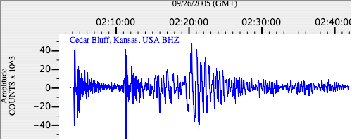
|
| US.CBKS. .BHN 56.685425 AD 2005.09.26 02:00:06.012 GMT |
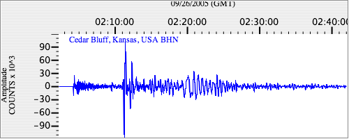
|
| US.CBKS. .BHE 41.677757 AD 2005.09.26 02:00:06.112 GMT |
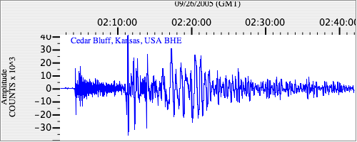
|