Seismograms for this Event
Event Info
| Region | Northern Peru |
| Time | 2005-09-25 21:55:34 -0400 |
| Magnitude | 7.5 MO, |
| Depth | 85.4 km |
| Latitude | -5.6567 |
| Longitude | -76.3661 |
| Distance | 54.448 deg |
| Azimuth | 318.657 deg |
| Back Azimuth | 128.026 deg |
Station Info
| Id | PFO |
| Name | Pinon Flat, California, USA |
| Latitude | 33.6092 |
| Longitude | -116.4553 |
| Begin Time | 1986-10-23 20:00:00 -0400 |
| End Time | 2599-12-31 18:59:59 -0500 |
Seismograms
| II.PFO.00.BHZ 71.00488 AD 2005.09.26 02:00:18.300 GMT |
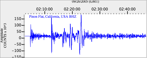
|
| II.PFO.00.BHN 23.81041 AD 2005.09.26 02:00:17.900 GMT |
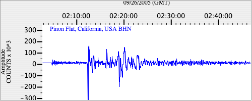
|
| II.PFO.00.BHE 29.870806 AD 2005.09.26 02:00:17.900 GMT |
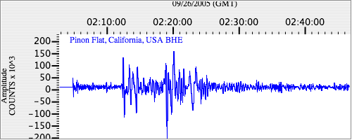
|