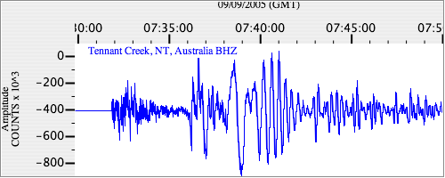
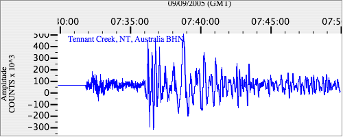
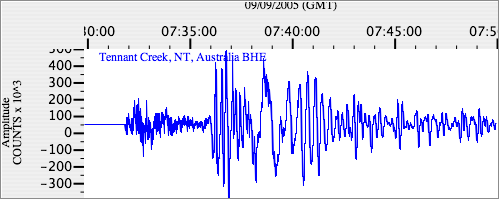
Seismograms for this Event
Event Info
| Region | New Ireland Region, P.N.G. |
| Time | 2005-09-09 03:26:43 -0400 |
| Magnitude | 6.3 MB, 7.7 MW, 7.5 MW, |
| Depth | 90.0 km |
| Latitude | -4.539 |
| Longitude | 153.474 |
| Distance | 24.099 deg |
| Azimuth | 228.981 deg |
| Back Azimuth | 53.08 deg |
Station Info
| Id | WRAB |
| Name | Tennant Creek, NT, Australia |
| Latitude | -19.9336 |
| Longitude | 134.36 |
| Begin Time | 1994-03-26 19:00:00 -0500 |
| End Time | 2599-12-31 18:59:59 -0500 |
Seismograms
| II.WRAB.00.BHZ 39.12958 AD 2005.09.09 07:22:19.450 GMT |
|
| II.WRAB.00.BHN 25.109566 AD 2005.09.09 07:23:43.050 GMT |
|
| II.WRAB.00.BHE 27.675228 AD 2005.09.09 07:23:40.250 GMT |
|