Seismograms for this Event
Event Info
| Region | Near East Coast Of Honshu, Japan |
| Time | 2005-08-15 22:46:28 -0400 |
| Magnitude | 6.5 MB, 6.8 MS, 7.2 MW, 7.1 MW, |
| Depth | 36.0 km |
| Latitude | 38.276 |
| Longitude | 142.039 |
| Distance | 91.83 deg |
| Azimuth | 36.059 deg |
| Back Azimuth | 323.968 deg |
Station Info
| Id | WCI |
| Name | Wyandotte Cave, Indiana, USA |
| Latitude | 38.229 |
| Longitude | -86.29381 |
| Begin Time | 1996-11-05 19:00:00 -0500 |
| End Time | 2599-12-31 18:59:59 -0500 |
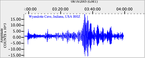
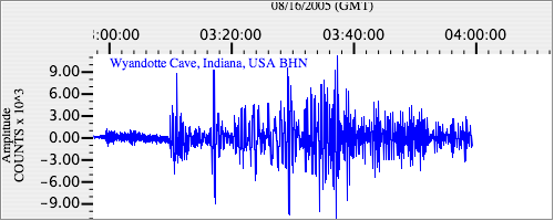
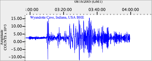
Seismograms
| US.WCI. .BHZ 7.4923005 AD 2005.08.16 02:55:18.521 GMT |
|
| US.WCI. .BHN 2.5578673 AD 2005.08.16 02:55:18.921 GMT |
|
| US.WCI. .BHE 2.2733266 AD 2005.08.16 02:55:18.721 GMT |
|