Seismograms for this Event
Event Info
| Region | Near East Coast Of Honshu, Japan |
| Time | 2005-08-15 22:46:28 -0400 |
| Magnitude | 6.5 MB, 6.8 MS, 7.2 MW, 7.1 MW, |
| Depth | 36.0 km |
| Latitude | 38.276 |
| Longitude | 142.039 |
| Distance | 76.17 deg |
| Azimuth | 49.592 deg |
| Back Azimuth | 308.52 deg |
Station Info
| Id | DUG |
| Name | Dugway, Tooele County, Utah, USA |
| Latitude | 40.195 |
| Longitude | -112.8133 |
| Begin Time | 1993-02-17 19:00:00 -0500 |
| End Time | 2999-12-31 18:59:59 -0500 |
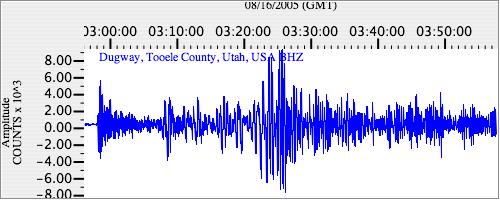
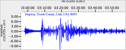
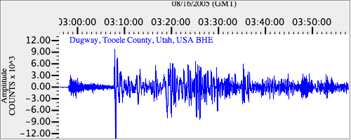
Seismograms
| US.DUG. .BHZ 8.869318 AD 2005.08.16 02:53:52.749 GMT |
|
| US.DUG. .BHN 2.9518464 AD 2005.08.16 02:53:37.799 GMT |
|
| US.DUG. .BHE 3.3306794 AD 2005.08.16 02:53:41.149 GMT |
|