Seismograms for this Event
Event Info
| Region | Near East Coast Of Honshu, Japan |
| Time | 2005-08-15 22:46:28 -0400 |
| Magnitude | 6.5 MB, 6.8 MS, 7.2 MW, 7.1 MW, |
| Depth | 36.0 km |
| Latitude | 38.276 |
| Longitude | 142.039 |
| Distance | 77.945 deg |
| Azimuth | 56.742 deg |
| Back Azimuth | 307.942 deg |
Station Info
| Id | PFO |
| Name | Pinon Flat, California, USA |
| Latitude | 33.6092 |
| Longitude | -116.4553 |
| Begin Time | 1986-10-23 20:00:00 -0400 |
| End Time | 2599-12-31 18:59:59 -0500 |
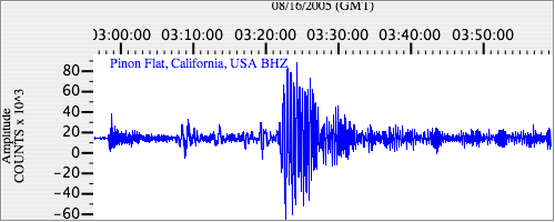
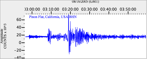
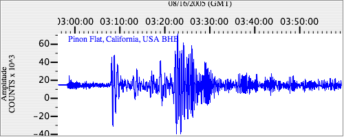
Seismograms
| II.PFO.00.BHZ 3.7919755 AD 2005.08.16 02:53:25.000 GMT |
|
| II.PFO.00.BHN 2.141318 AD 2005.08.16 02:53:06.200 GMT |
|
| II.PFO.00.BHE 2.6460118 AD 2005.08.16 02:53:12.800 GMT |
|