Seismograms for this Event
Event Info
| Region | Off Coast Of Northern California |
| Time | 2005-06-14 22:50:53 -0400 |
| Magnitude | 6.2 MB, 7.1 MS, 7.2 MW, 7.1 MW, |
| Depth | 10.0 km |
| Latitude | 41.301 |
| Longitude | -125.97 |
| Distance | 6.66 deg |
| Azimuth | 112.927 deg |
| Back Azimuth | 297.924 deg |
Station Info
| Id | MNV |
| Name | Mina, Nevada, USA |
| Latitude | 38.4328 |
| Longitude | -118.1531 |
| Begin Time | 1994-12-21 19:00:00 -0500 |
| End Time | 2999-12-31 18:59:59 -0500 |
Seismograms
| US.MNV. .BHZ 13.943734 AD 2005.06.15 02:48:21.186 GMT |
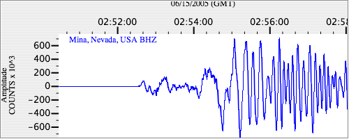
|
| US.MNV. .BHN 6.4146256 AD 2005.06.15 02:48:21.186 GMT |
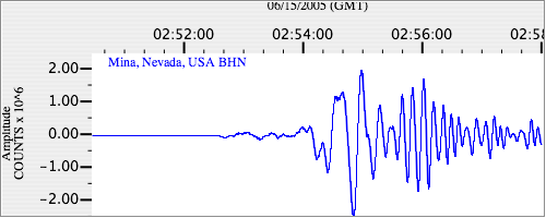
|
| US.MNV. .BHE 12.0309515 AD 2005.06.15 02:48:21.186 GMT |
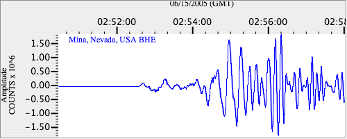
|