Seismograms for this Event
Event Info
| Region | Off Coast Of Northern California |
| Time | 2005-06-14 22:50:53 -0400 |
| Magnitude | 6.2 MB, 7.1 MS, 7.2 MW, 7.1 MW, |
| Depth | 10.0 km |
| Latitude | 41.301 |
| Longitude | -125.97 |
| Distance | 19.086 deg |
| Azimuth | 113.558 deg |
| Back Azimuth | 305.88 deg |
Station Info
| Id | MNTX |
| Name | Cornudas Mountains, Texas, USA |
| Latitude | 31.6985 |
| Longitude | -105.3821 |
| Begin Time | 2004-04-01 01:00:00 -0500 |
| End Time | 2999-12-31 18:59:59 -0500 |
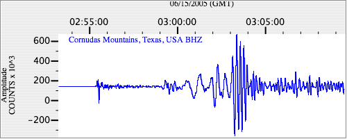
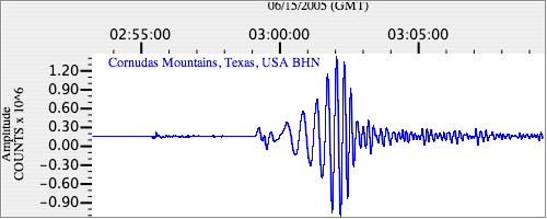
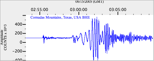
Seismograms
| US.MNTX. .BHZ 7.6566343 AD 2005.06.15 02:51:01.168 GMT |
|
| US.MNTX. .BHN 2.5431063 AD 2005.06.15 02:51:01.018 GMT |
|
| US.MNTX. .BHE 6.8832736 AD 2005.06.15 02:50:58.068 GMT |
|