Seismograms for this Event
Event Info
| Region | Off Coast Of Northern California |
| Time | 2005-06-14 22:50:53 -0400 |
| Magnitude | 6.2 MB, 7.1 MS, 7.2 MW, 7.1 MW, |
| Depth | 10.0 km |
| Latitude | 41.301 |
| Longitude | -125.97 |
| Distance | 21.698 deg |
| Azimuth | 116.323 deg |
| Back Azimuth | 309.34 deg |
Station Info
| Id | LTX |
| Name | Lajitas, Texas, USA |
| Latitude | 29.3339 |
| Longitude | -103.6669 |
| Begin Time | 1998-05-15 20:00:00 -0400 |
| End Time | 2999-12-31 18:59:59 -0500 |
Seismograms
| US.LTX. .BHZ 13.472223 AD 2005.06.15 02:51:24.374 GMT |
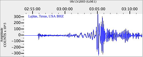
|
| US.LTX. .BHN 10.004343 AD 2005.06.15 02:51:26.674 GMT |
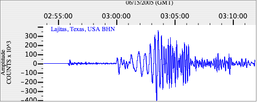
|
| US.LTX. .BHE 9.313158 AD 2005.06.15 02:51:26.074 GMT |
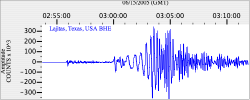
|