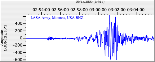
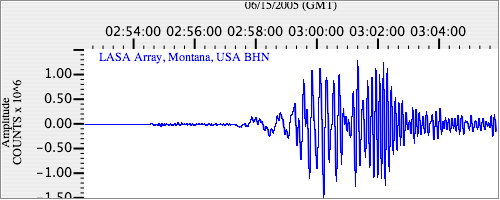
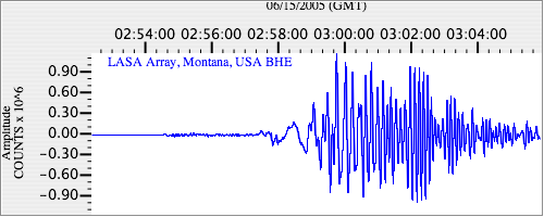
Seismograms for this Event
Event Info
| Region | Off Coast Of Northern California |
| Time | 2005-06-14 22:50:53 -0400 |
| Magnitude | 6.2 MB, 7.1 MS, 7.2 MW, 7.1 MW, |
| Depth | 10.0 km |
| Latitude | 41.301 |
| Longitude | -125.97 |
| Distance | 15.185 deg |
| Azimuth | 62.615 deg |
| Back Azimuth | 256.369 deg |
Station Info
| Id | LAO |
| Name | LASA Array, Montana, USA |
| Latitude | 46.6885 |
| Longitude | -106.2231 |
| Begin Time | 2004-07-14 20:00:00 -0400 |
| End Time | 2999-12-31 18:59:59 -0500 |
Seismograms
| US.LAO. .BHZ 6.776462 AD 2005.06.15 02:50:04.578 GMT |
|
| US.LAO. .BHN 2.1560674 AD 2005.06.15 02:50:07.878 GMT |
|
| US.LAO. .BHE 2.6884682 AD 2005.06.15 02:50:08.178 GMT |
|