Seismograms for this Event
Event Info
| Region | Off Coast Of Northern California |
| Time | 2005-06-14 22:50:53 -0400 |
| Magnitude | 6.2 MB, 7.1 MS, 7.2 MW, 7.1 MW, |
| Depth | 10.0 km |
| Latitude | 41.301 |
| Longitude | -125.97 |
| Distance | 20.209 deg |
| Azimuth | 88.414 deg |
| Back Azimuth | 285.408 deg |
Station Info
| Id | CBKS |
| Name | Cedar Bluff, Kansas, USA |
| Latitude | 38.814 |
| Longitude | -99.7374 |
| Begin Time | 1994-09-11 20:00:00 -0400 |
| End Time | 2999-12-31 18:59:59 -0500 |
Seismograms
| US.CBKS. .BHZ 36.074425 AD 2005.06.15 02:51:14.222 GMT |
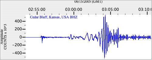
|
| US.CBKS. .BHN 5.342741 AD 2005.06.15 02:51:11.322 GMT |
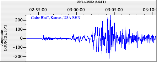
|
| US.CBKS. .BHE 23.741812 AD 2005.06.15 02:51:25.922 GMT |
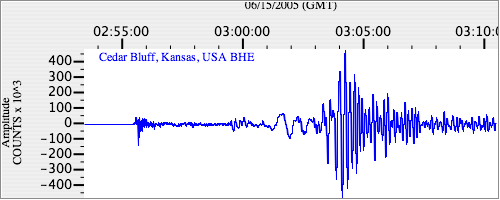
|