Seismograms for this Event
Event Info
| Region | Northern Chile |
| Time | 2005-06-13 18:44:33 -0400 |
| Magnitude | 6.8 MB, 7.8 MW, 7.8 MW, |
| Depth | 115.6 km |
| Latitude | -19.987 |
| Longitude | -69.197 |
| Distance | 61.26 deg |
| Azimuth | 332.373 deg |
| Back Azimuth | 148.024 deg |
Station Info
| Id | WMOK |
| Name | Wichita Mountains, Oklahoma, USA |
| Latitude | 34.7379 |
| Longitude | -98.781 |
| Begin Time | 1992-11-11 19:00:00 -0500 |
| End Time | 2999-12-31 18:59:59 -0500 |
Seismograms
| US.WMOK. .BHZ 501.4848 AD 2005.06.13 22:50:02.625 GMT |
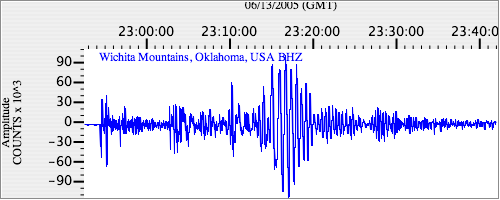
|
| US.WMOK. .BHN 87.59932 AD 2005.06.13 22:50:29.475 GMT |
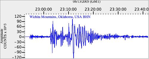
|
| US.WMOK. .BHE 27.78147 AD 2005.06.13 22:50:27.225 GMT |
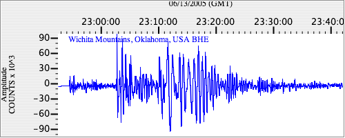
|