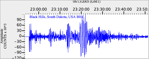
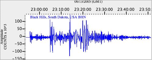
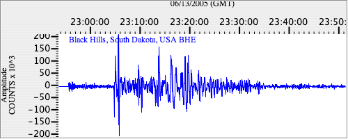
Seismograms for this Event
Event Info
| Region | Northern Chile |
| Time | 2005-06-13 18:44:33 -0400 |
| Magnitude | 6.8 MB, 7.8 MW, 7.8 MW, |
| Depth | 115.6 km |
| Latitude | -19.987 |
| Longitude | -69.197 |
| Distance | 71.323 deg |
| Azimuth | 334.259 deg |
| Back Azimuth | 145.448 deg |
Station Info
| Id | RSSD |
| Name | Black Hills, South Dakota, USA |
| Latitude | 44.1204 |
| Longitude | -104.036 |
| Begin Time | 1999-09-23 20:00:00 -0400 |
| End Time | 2599-12-31 18:59:59 -0500 |
Seismograms
| US.RSSD. .BHZ 486.92706 AD 2005.06.13 22:51:27.123 GMT |
|
| US.RSSD. .BHN 285.1251 AD 2005.06.13 22:51:27.522 GMT |
|
| US.RSSD. .BHE 119.893234 AD 2005.06.13 22:51:29.922 GMT |
|