Seismograms for this Event
Event Info
| Region | Northern Chile |
| Time | 2005-06-13 18:44:33 -0400 |
| Magnitude | 6.8 MB, 7.8 MW, 7.8 MW, |
| Depth | 115.6 km |
| Latitude | -19.987 |
| Longitude | -69.197 |
| Distance | 77.782 deg |
| Azimuth | 330.361 deg |
| Back Azimuth | 137.359 deg |
Station Info
| Id | MSO |
| Name | Missoula, Montana, USA |
| Latitude | 46.8292 |
| Longitude | -113.9406 |
| Begin Time | 2002-08-23 13:00:00 -0400 |
| End Time | 2999-12-31 18:59:59 -0500 |
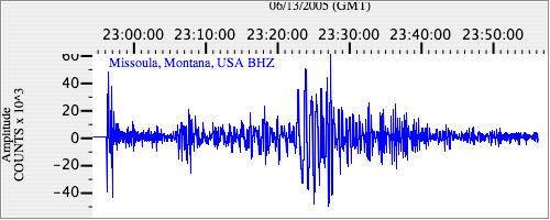
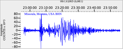
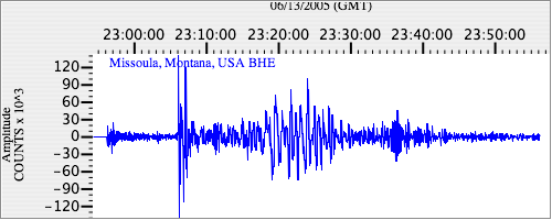
Seismograms
| US.MSO. .BHZ 331.68857 AD 2005.06.13 22:52:09.869 GMT |
|
| US.MSO. .BHN 85.33068 AD 2005.06.13 22:52:03.869 GMT |
|
| US.MSO. .BHE 37.040115 AD 2005.06.13 22:52:05.269 GMT |
|