Seismograms for this Event
Event Info
| Region | Northern Chile |
| Time | 2005-06-13 18:44:33 -0400 |
| Magnitude | 6.8 MB, 7.8 MW, 7.8 MW, |
| Depth | 115.6 km |
| Latitude | -19.987 |
| Longitude | -69.197 |
| Distance | 74.31 deg |
| Azimuth | 334.495 deg |
| Back Azimuth | 143.966 deg |
Station Info
| Id | LAO |
| Name | LASA Array, Montana, USA |
| Latitude | 46.6885 |
| Longitude | -106.2231 |
| Begin Time | 2004-07-14 20:00:00 -0400 |
| End Time | 2999-12-31 18:59:59 -0500 |
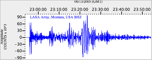
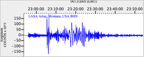
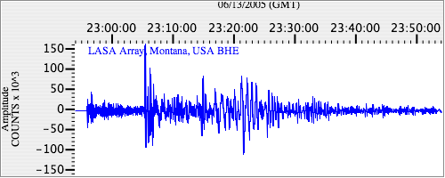
Seismograms
| US.LAO. .BHZ 326.3023 AD 2005.06.13 22:51:41.153 GMT |
|
| US.LAO. .BHN 37.822582 AD 2005.06.13 22:51:44.703 GMT |
|
| US.LAO. .BHE 36.432194 AD 2005.06.13 22:51:55.103 GMT |
|