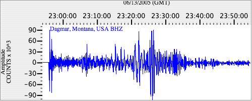
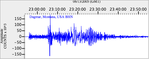
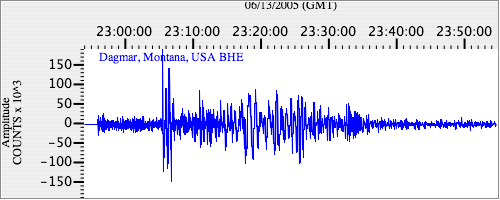
Seismograms for this Event
Event Info
| Region | Northern Chile |
| Time | 2005-06-13 18:44:33 -0400 |
| Magnitude | 6.8 MB, 7.8 MW, 7.8 MW, |
| Depth | 115.6 km |
| Latitude | -19.987 |
| Longitude | -69.197 |
| Distance | 74.983 deg |
| Azimuth | 336.721 deg |
| Back Azimuth | 146.047 deg |
Station Info
| Id | DGMT |
| Name | Dagmar, Montana, USA |
| Latitude | 48.4702 |
| Longitude | -104.1959 |
| Begin Time | 2004-07-14 20:00:00 -0400 |
| End Time | 2999-12-31 18:59:59 -0500 |
Seismograms
| US.DGMT. .BHZ 222.15263 AD 2005.06.13 22:51:54.436 GMT |
|
| US.DGMT. .BHN 59.20978 AD 2005.06.13 22:51:49.336 GMT |
|
| US.DGMT. .BHE 40.890587 AD 2005.06.13 22:51:52.536 GMT |
|