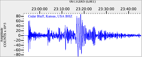
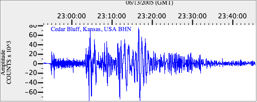
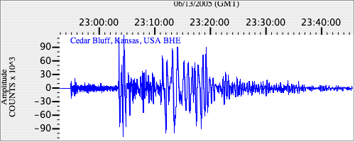
Seismograms for this Event
Event Info
| Region | Northern Chile |
| Time | 2005-06-13 18:44:33 -0400 |
| Magnitude | 6.8 MB, 7.8 MW, 7.8 MW, |
| Depth | 115.6 km |
| Latitude | -19.987 |
| Longitude | -69.197 |
| Distance | 65.12 deg |
| Azimuth | 334.05 deg |
| Back Azimuth | 148.21 deg |
Station Info
| Id | CBKS |
| Name | Cedar Bluff, Kansas, USA |
| Latitude | 38.814 |
| Longitude | -99.7374 |
| Begin Time | 1994-09-11 20:00:00 -0400 |
| End Time | 2999-12-31 18:59:59 -0500 |
Seismograms
| US.CBKS. .BHZ 346.67 AD 2005.06.13 22:50:58.797 GMT |
|
| US.CBKS. .BHN 24.601294 AD 2005.06.13 22:50:40.997 GMT |
|
| US.CBKS. .BHE 61.835297 AD 2005.06.13 22:50:57.997 GMT |
|