Seismograms for this Event
Event Info
| Region | Northern Chile |
| Time | 2005-06-13 18:44:33 -0400 |
| Magnitude | 6.8 MB, 7.8 MW, 7.8 MW, |
| Depth | 115.6 km |
| Latitude | -19.987 |
| Longitude | -69.197 |
| Distance | 69.788 deg |
| Azimuth | 319.223 deg |
| Back Azimuth | 132.604 deg |
Station Info
| Id | PFO |
| Name | Pinon Flat, California, USA |
| Latitude | 33.6092 |
| Longitude | -116.4553 |
| Begin Time | 1986-10-23 20:00:00 -0400 |
| End Time | 2599-12-31 18:59:59 -0500 |
Seismograms
| II.PFO.00.BHZ 112.75453 AD 2005.06.13 22:49:42.500 GMT |
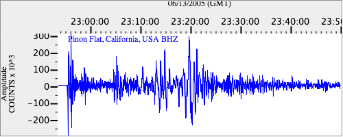
|
| II.PFO.00.BHN 32.688805 AD 2005.06.13 22:47:24.400 GMT |
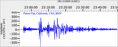
|
| II.PFO.00.BHE 34.38258 AD 2005.06.13 22:47:14.600 GMT |
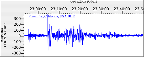
|