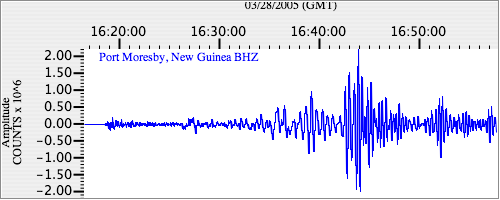
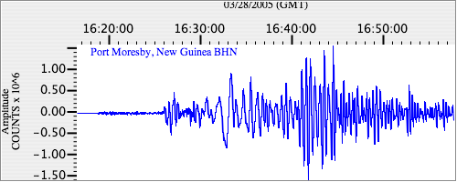
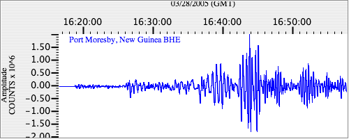
Seismograms for this Event
Event Info
| Region | Northern Sumatra, Indonesia |
| Time | 2005-03-28 11:09:36 -0500 |
| Magnitude | 7.2 MB, 8.4 MS, 8.6 MW, 8.1 MW, |
| Depth | 30.0 km |
| Latitude | 2.085 |
| Longitude | 97.108 |
| Distance | 51.144 deg |
| Azimuth | 103.759 deg |
| Back Azimuth | 280.349 deg |
Station Info
| Id | PMG |
| Name | Port Moresby, New Guinea |
| Latitude | -9.4092 |
| Longitude | 147.1539 |
| Begin Time | 1997-08-18 20:00:00 -0400 |
| End Time | 2599-12-31 18:59:59 -0500 |
Seismograms
| IU.PMG.00.BHZ 10.933919 AD 2005.03.28 16:12:05.311 GMT |
|
| IU.PMG.00.BHN 2.322148 AD 2005.03.28 16:07:16.011 GMT |
|
| IU.PMG.00.BHE 4.899034 AD 2005.03.28 16:08:39.411 GMT |
|