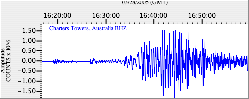
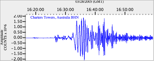
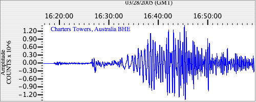
Seismograms for this Event
Event Info
| Region | Northern Sumatra, Indonesia |
| Time | 2005-03-28 11:09:36 -0500 |
| Magnitude | 7.2 MB, 8.4 MS, 8.6 MW, 8.1 MW, |
| Depth | 30.0 km |
| Latitude | 2.085 |
| Longitude | 97.108 |
| Distance | 52.981 deg |
| Azimuth | 117.076 deg |
| Back Azimuth | 288.789 deg |
Station Info
| Id | CTAO |
| Name | Charters Towers, Australia |
| Latitude | -20.0882 |
| Longitude | 146.2545 |
| Begin Time | 1998-10-06 17:00:00 -0400 |
| End Time | 2599-12-31 18:59:59 -0500 |
Seismograms
| IU.CTAO.00.BHZ 8.39825 AD 2005.03.28 16:07:30.161 GMT |
|
| IU.CTAO.00.BHN 2.906113 AD 2005.03.28 16:09:01.761 GMT |
|
| IU.CTAO.00.BHE 5.5465794 AD 2005.03.28 16:10:40.861 GMT |
|