Seismograms for this Event
Event Info
| Region | Northern Sumatra, Indonesia |
| Time | 2005-03-28 11:09:36 -0500 |
| Magnitude | 7.2 MB, 8.4 MS, 8.6 MW, 8.1 MW, |
| Depth | 30.0 km |
| Latitude | 2.085 |
| Longitude | 97.108 |
| Distance | 17.139 deg |
| Azimuth | 288.045 deg |
| Back Azimuth | 106.705 deg |
Station Info
| Id | PALK |
| Name | Pallekele, Sri Lanka |
| Latitude | 7.2728 |
| Longitude | 80.7022 |
| Begin Time | 2000-08-21 20:00:00 -0400 |
| End Time | 2599-12-31 18:59:59 -0500 |
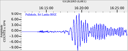
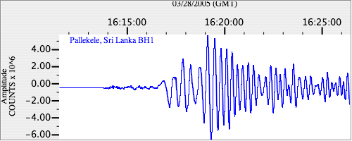
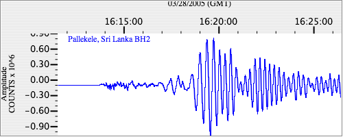
Seismograms
| II.PALK.00.BHZ 8.723412 AD 2005.03.28 16:07:19.083 GMT |
|
| II.PALK.00.BH1 4.4432254 AD 2005.03.28 16:07:11.283 GMT |
|
| II.PALK.00.BH2 13.660003 AD 2005.03.28 16:07:31.083 GMT |
|