Seismograms for this Event
Event Info
| Region | Banda Sea |
| Time | 2005-03-02 05:42:09 -0500 |
| Magnitude | 7.1 M, |
| Depth | 190.5 km |
| Latitude | -6.51 |
| Longitude | 129.84 |
| Distance | 20.882 deg |
| Azimuth | 131.829 deg |
| Back Azimuth | 308.026 deg |
Station Info
| Id | CTAO |
| Name | Charters Towers, Australia |
| Latitude | -20.0882 |
| Longitude | 146.2545 |
| Begin Time | 1998-10-06 17:00:00 -0400 |
| End Time | 2599-12-31 18:59:59 -0500 |
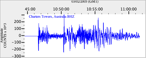
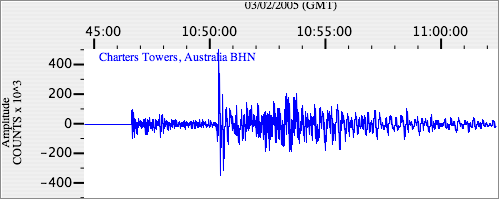
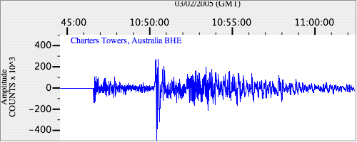
Seismograms
| IU.CTAO.00.BHZ 294.983 AD 2005.03.02 10:37:12.511 GMT |
|
| IU.CTAO.00.BHN 173.87447 AD 2005.03.02 10:38:14.311 GMT |
|
| IU.CTAO.00.BHE 238.78168 AD 2005.03.02 10:41:53.411 GMT |
|