Seismograms for this Event
Event Info
| Region | Mindanao, Philippines |
| Time | 2005-02-05 07:23:15 -0500 |
| Magnitude | 7.1 MO, |
| Depth | 486.3 km |
| Latitude | 5.3634 |
| Longitude | 123.2288 |
| Distance | 19.57 deg |
| Azimuth | 355.303 deg |
| Back Azimuth | 174.846 deg |
Station Info
| Id | TATO |
| Name | Taipei, Taiwan |
| Latitude | 24.9735 |
| Longitude | 121.4971 |
| Begin Time | 1992-09-25 20:00:00 -0400 |
| End Time | 2599-12-31 18:59:59 -0500 |
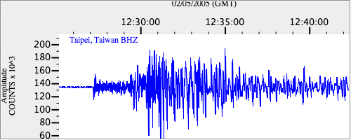
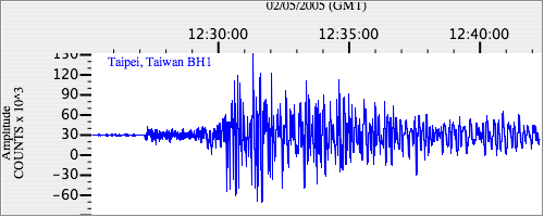
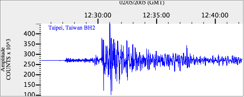
Seismograms
| IU.TATO.00.BHZ 10.190244 AD 2005.02.05 12:19:02.010 GMT |
|
| IU.TATO.00.BH1 3.6221356 AD 2005.02.05 12:18:48.310 GMT |
|
| IU.TATO.00.BH2 3.33489 AD 2005.02.05 12:17:24.910 GMT |
|