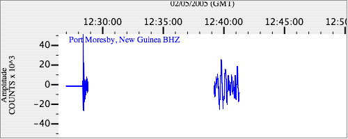
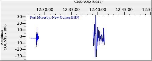
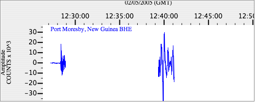
Seismograms for this Event
Event Info
| Region | Mindanao, Philippines |
| Time | 2005-02-05 07:23:15 -0500 |
| Magnitude | 7.1 MO, |
| Depth | 486.3 km |
| Latitude | 5.3634 |
| Longitude | 123.2288 |
| Distance | 27.998 deg |
| Azimuth | 121.526 deg |
| Back Azimuth | 300.667 deg |
Station Info
| Id | PMG |
| Name | Port Moresby, New Guinea |
| Latitude | -9.4092 |
| Longitude | 147.1539 |
| Begin Time | 1997-08-18 20:00:00 -0400 |
| End Time | 2599-12-31 18:59:59 -0500 |
Seismograms
| IU.PMG.00.BHZ 108.87696 AD 2005.02.05 12:25:31.610 GMT |
|
| IU.PMG.00.BHN 48.08597 AD 2005.02.05 12:26:14.210 GMT |
|
| IU.PMG.00.BHE 42.990295 AD 2005.02.05 12:26:04.510 GMT |
|