Seismograms for this Event
Event Info
| Region | Mindanao, Philippines |
| Time | 2005-02-05 07:23:15 -0500 |
| Magnitude | 7.1 MO, |
| Depth | 486.3 km |
| Latitude | 5.3634 |
| Longitude | 123.2288 |
| Distance | 33.938 deg |
| Azimuth | 21.89 deg |
| Back Azimuth | 207.448 deg |
Station Info
| Id | MAJO |
| Name | Matsushiro, Japan |
| Latitude | 36.5425 |
| Longitude | 138.2073 |
| Begin Time | 1997-11-18 19:00:00 -0500 |
| End Time | 2599-12-31 18:59:59 -0500 |
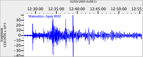
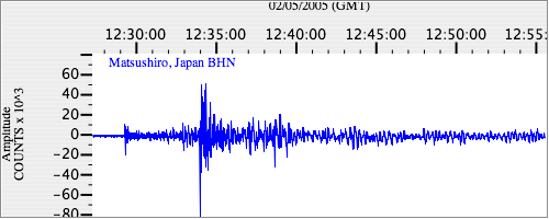
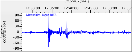
Seismograms
| IU.MAJO.00.BHZ 13.310253 AD 2005.02.05 12:20:36.623 GMT |
|
| IU.MAJO.00.BHN 6.93579 AD 2005.02.05 12:22:52.623 GMT |
|
| IU.MAJO.00.BHE 3.3419173 AD 2005.02.05 12:22:49.423 GMT |
|