Seismograms for this Event
Event Info
| Region | Mindanao, Philippines |
| Time | 2005-02-05 07:23:15 -0500 |
| Magnitude | 7.1 MO, |
| Depth | 486.3 km |
| Latitude | 5.3634 |
| Longitude | 123.2288 |
| Distance | 39.434 deg |
| Azimuth | 111.767 deg |
| Back Azimuth | 290.414 deg |
Station Info
| Id | HNR |
| Name | Honiara, Solomon Islands |
| Latitude | -9.4322 |
| Longitude | 159.9471 |
| Begin Time | 1998-03-08 22:50:00 -0500 |
| End Time | 2599-12-31 18:59:59 -0500 |
Seismograms
| IU.HNR.00.BHZ 46.404858 AD 2005.02.05 12:22:42.562 GMT |
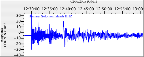
|
| IU.HNR.00.BH1 20.63492 AD 2005.02.05 12:19:50.762 GMT |
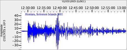
|
| IU.HNR.00.BH2 20.614504 AD 2005.02.05 12:22:03.562 GMT |
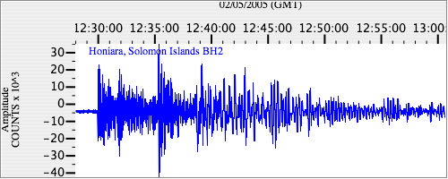
|