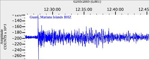
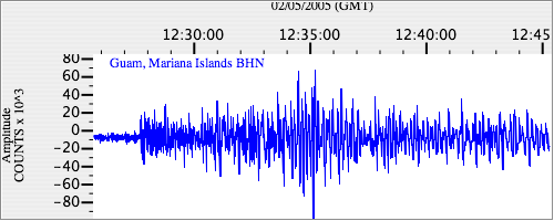
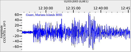
Seismograms for this Event
Event Info
| Region | Mindanao, Philippines |
| Time | 2005-02-05 07:23:15 -0500 |
| Magnitude | 7.1 MO, |
| Depth | 486.3 km |
| Latitude | 5.3634 |
| Longitude | 123.2288 |
| Distance | 22.838 deg |
| Azimuth | 67.498 deg |
| Back Azimuth | 251.089 deg |
Station Info
| Id | GUMO |
| Name | Guam, Mariana Islands |
| Latitude | 13.5892 |
| Longitude | 144.8684 |
| Begin Time | 1997-11-20 19:00:00 -0500 |
| End Time | 2599-12-31 18:59:59 -0500 |
Seismograms
| IU.GUMO.00.BHZ 10.133314 AD 2005.02.05 12:20:05.011 GMT |
|
| IU.GUMO.00.BHN 2.859446 AD 2005.02.05 12:22:33.411 GMT |
|
| IU.GUMO.00.BHE 5.826953 AD 2005.02.05 12:21:31.811 GMT |
|