Seismograms for this Event
Event Info
| Region | Mindanao, Philippines |
| Time | 2005-02-05 07:23:15 -0500 |
| Magnitude | 7.1 MO, |
| Depth | 486.3 km |
| Latitude | 5.3634 |
| Longitude | 123.2288 |
| Distance | 27.419 deg |
| Azimuth | 156.77 deg |
| Back Azimuth | 335.328 deg |
Station Info
| Id | WRAB |
| Name | Tennant Creek, NT, Australia |
| Latitude | -19.9336 |
| Longitude | 134.36 |
| Begin Time | 1994-03-26 19:00:00 -0500 |
| End Time | 2599-12-31 18:59:59 -0500 |
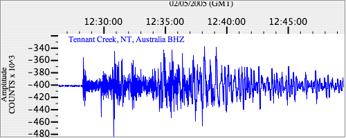
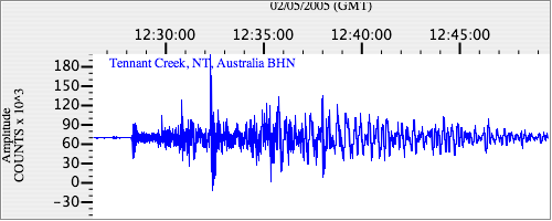
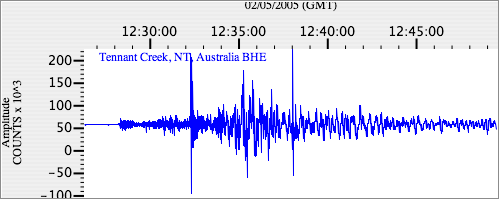
Seismograms
| II.WRAB.00.BHZ 27.004648 AD 2005.02.05 12:24:07.850 GMT |
|
| II.WRAB.00.BHN 18.609404 AD 2005.02.05 12:19:09.050 GMT |
|
| II.WRAB.00.BHE 11.605962 AD 2005.02.05 12:18:55.850 GMT |
|